Hiking · Central mountains
Pico Ruivo
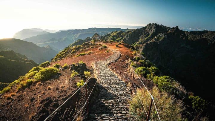
Pico Ruivo is the highest peak in Madeira and the Madeira Archipelago, rising to 1,862 metres above sea level. Located in the central mountain massif, it offers a wide panorama of volcanic ridges, deep valleys and the island’s north and south slopes. Unlike Pico do Arieiro, Pico Ruivo has no road to the summit: every visit requires a hike.
History and character
For centuries, Pico Ruivo was known mainly to shepherds, farmers and people travelling between mountain communities. The summit later became important for surveying, conservation and mountain walking because it stands at the highest point of the island. It did not become a tourist attraction through one single construction project; its popularity grew as marked trails, roads to mountain starting points and visitor infrastructure made the central massif more accessible. The route from Achada do Teixeira, now known as PR1.2 – Vereda do Pico Ruivo, provides the most direct approach. The longer PR1 – Vereda do Areeiro connects Pico do Arieiro, Pico das Torres and Pico Ruivo across the high ridge. The mountain sits within a protected high-altitude landscape of the Central Mountain Massif, where strong wind, fog, heavy rain and rapid temperature changes have shaped both the vegetation and the experience of walking here.
Why visit
- At 1,862 metres, the highest peak in Madeira and the Madeira Archipelago
- A summit reached only on foot, which gives the visit a more remote mountain character than Pico do Arieiro
- PR1.2 – Vereda do Pico Ruivo from Achada do Teixeira, the most direct marked route to the summit
- PR1 – Vereda do Areeiro, the dramatic high-ridge route linking Pico do Arieiro, Pico das Torres and Pico Ruivo
- Panoramic views over the Central Mountain Massif, north-coast valleys and, in clear conditions, distant islands and the Atlantic
- High-altitude heath and mountain vegetation adapted to wind, mist, cold and heavy rain
- Casa de Abrigo do Pico Ruivo, a shelter area near the summit where visitors can rest
- A true high-mountain experience: fog, cloud inversions and rapidly changing light can transform the landscape within minutes
Practical tip
Check the official trail status and mountain forecast before travelling. PR1.2 from Achada do Teixeira is the usual shorter approach, but it still involves uphill walking at high altitude. Wear layers, waterproof clothing and shoes with good grip, carry water and food, and do not start PR1 from Pico do Arieiro unless its full current status and access conditions have been confirmed.