Hiking · East peninsula
Vereda da Ponta de São Lourenço
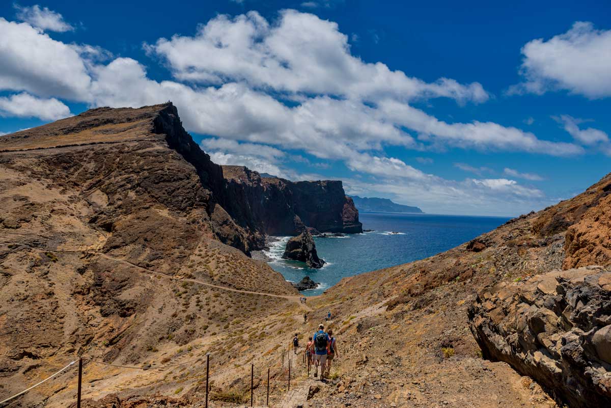
Ponta de São Lourenço is Madeira’s easternmost peninsula: a long, wind-shaped landscape of volcanic rock, dry grassland and steep cliffs above the Atlantic. It looks very different from the lush, green interior of the island and is one of Madeira’s most memorable coastal walks. The peninsula was among the first parts of Madeira seen by Portuguese navigators in 1419 and was named after São Lourenço, the ship associated with the island’s discovery.
History and character
Ponta de São Lourenço has long been shaped by its exposed location, scarce freshwater and difficult terrain. Unlike the wetter mountains of Madeira, its dry climate and strong winds support a distinctive coastal ecosystem rather than dense forest. The peninsula was classified as a protected nature reserve in 1982 to safeguard its geology, plants, seabirds and coastal habitats. The modern walking route, PR8 – Vereda da Ponta de São Lourenço, begins at Baía d’Abra and follows the eastern peninsula towards Cais do Sardinha. It is about 3 km each way to Casa do Sardinha, with a further uphill section towards Pico do Furado for broader views. Casa do Sardinha has its own story: Manuel Bettencourt Sardinha built Cais do Abra in 1905 and then had the house constructed as a private refuge and holiday place. His family owned it until 1996, when it was sold to the Autonomous Region of Madeira on the condition that it would serve nature conservation. It was used as an observation and surveillance post until 2009, renovated in 2010 and reopened as the Casa do Sardinha Reception Centre. A bar attached to the centre began operating in 2019; today, the nearby Casa do Sardinha Sea Spot Cafe continues the historic name and provides a welcome stop in this remote setting.
Why visit
- Madeira’s easternmost peninsula, protected as a nature reserve since 1982
- PR8 – Vereda da Ponta de São Lourenço: around 3 km each way from Baía d’Abra to Casa do Sardinha
- Views across both the north and south sides of Madeira, with the Desertas Islands often visible in clear weather
- Dry volcanic landscape, red and ochre cliffs, basalt formations and grassland shaped by strong wind
- Endemic coastal plants and seabirds adapted to a far drier environment than the rest of Madeira
- Cais do Sardinha, a small sheltered bay and pier near the end of the main walking route
- Casa do Sardinha, built after 1905 as a private retreat, later transformed into a nature-reception centre in 2010
- Casa do Sardinha Sea Spot Cafe, a remote café reached by the PR8 trail or by boat
- Pico do Furado, an optional uphill viewpoint above Casa do Sardinha with wider panoramas
Practical tip
Start early because there is little shade and the wind can be strong. Take more water than you expect to need, sun protection, a windproof layer and shoes with good grip. Check the official trail status and access requirements before travelling, and do not rely on the café being open: carry food and water for the full return walk.